Contents
Index
Read MapInfo File
This option will read in a MapInfo .MIF and MID file into the job.
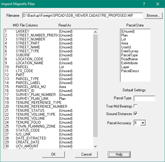
The polygon geometry is held in the .MIF file and the Parcel attributes (name, date, plan, etc ) are stored in the .MID file.
Enter the name of the file in the top window.
Below that are two windows.
On the left is a list of the data tables held in the .MID file and on the right is a table of the parcel data types.
To define where data has to be moved from the MID file to the correct place in the parcel data area,
use the mouse to select each item, then use the mouse to select the appropriate parcel data type for that item.
If there is no appropriate parcel data type to correspond with a MID value, set it to be “unused”.
As a minimum, a column should be set for the Lot and another set for the Plan.
Below the table of parcel data types is the area where default settings can be made.
These will be applied to all lots.
Parcel Type
This should be a number between 0 and 990
True Mid Bearings
Tick this if true mid bearings are to be calculated for the parcel lines.
The datum, zone and job centroid needs to be set for these values to be calculated correctly.Datum Zone
Ground Distances
Tick this if Ground distances are to be computed from the grid coordinates.
Parcel Accuracy
Select from a drop down list of the available accuracy categories.